|
Page
60
|
|
||
|
||
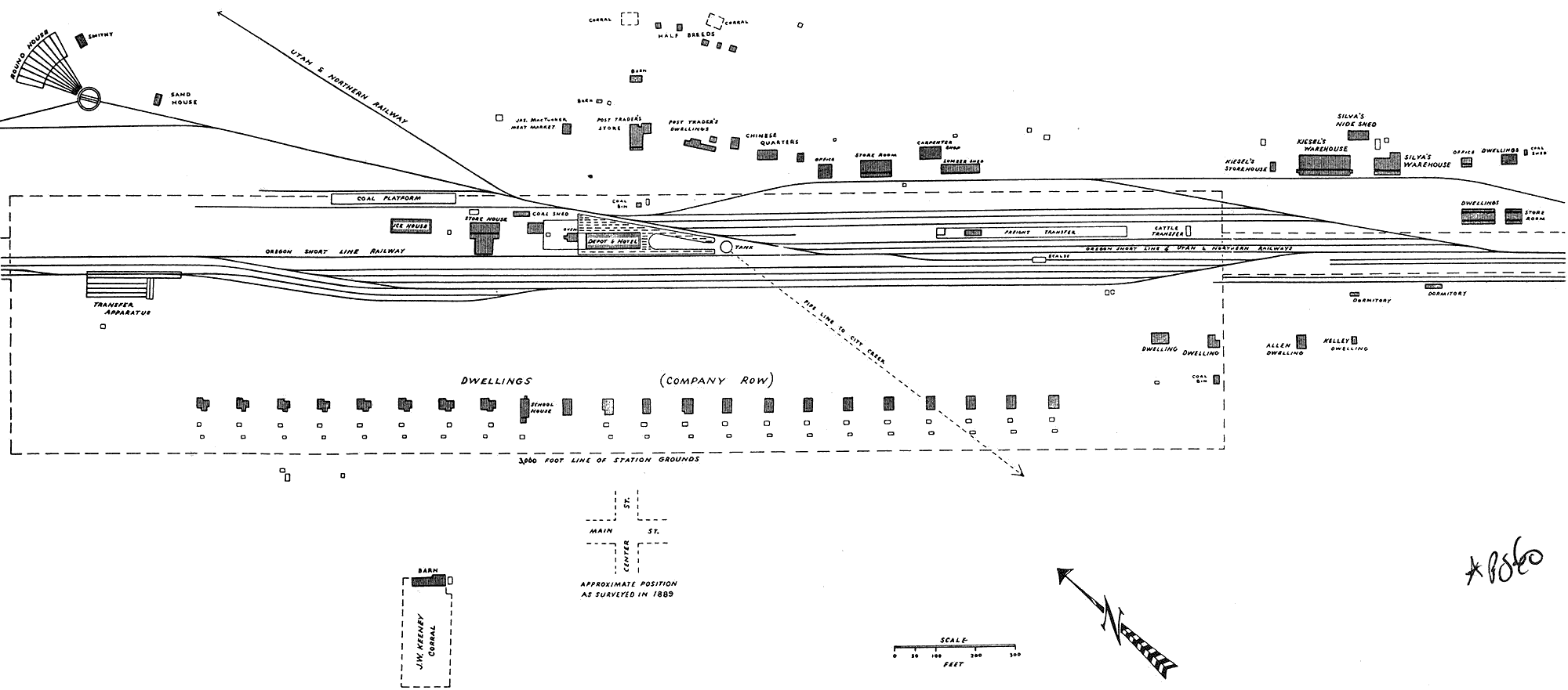
| Map
of Pocatello Junction, 1885, sketch from Wrigley, (1942, Fig. 14). Note
water pipeline to City Creek and ethnic businesses east of the tracks and
south of Center Street. The Warehouse District had also become established,
both on and off the Indian Reservation. |