Page
108
|
Page
108
|
|
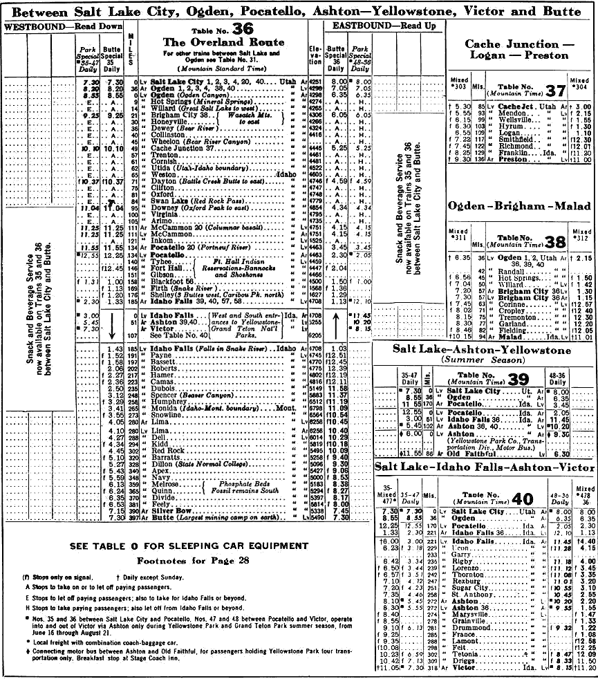
| Union Pacific timetable, January 27, 1964. Note the reference to "columnar basalt" at McCammon. Click on image for a larger view |
The
Lake Bonneville Flood
About
14,500 radiocarbon years ago, Lake Bonneville, which occupied much of the presently
settled part of Utah, overflowed through a dam of alluvial fan material at Red
Rock Pass at the north end of Cache Valley and produced the catastrophic Lake
Bonneville Flood which scoured and cleaned loose rocks from the canyon west
of Inkom. It is estimated that at Portneuf Narrows the floodwaters were 300
feet deep, (O'Conner, 1990).
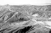
The flood removed the Basalt of Portneuf Valley from the Portneuf Narrows area and deposited basalt Boulders which are common in parts of downtown Pocatello. The topography left behind by the flood is called scabland topography, and is manifested in dry waterfalls, alcoves, scoured bedrock surfaces, and Boulder bar accumulations along the flood path. Such topography is easy to see both south and west of Inkom.
The
Abandoned Utah & Northern Railway Grade
The Utah
& Northern narrow-gauge rail line followed a grade along Marsh Creek and
generally on the south side of the Portneuf River through the canyon west of
Inkom. It crossed the Portneuf River on a bridge that still exists near Blackrock
and ran parallel to the present Union Pacific right of way through Portneuf
Narrows.