|
Page
119
|
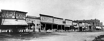
(left) Looking south towards Center Street, in the 100 block of Front Street (North 1st Ave.), about 1892. This was the rough side of town in the early years, and the interface with the Indian Reservation. Notice that the businesses are generally saloons and restaurants. The Wood River Restaurant is a long way from the Wood River. The Chinese compound and the walled city were one block south of Center on the east side of First Ave. The Phoenix Building stands at the southeast corner of First Ave. and East Center at the far right of the photo, Bannock County Historical Society Collection.
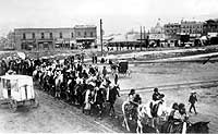
(above right) Parade of Indians cross the railroad from the east on Lander Street, 1904. Indians in full regalia often participated in 4th of July Parades. They usually camped on the east side of the tracks near between Lander and Fremont Streets. Bannock County Historical Society Collection.
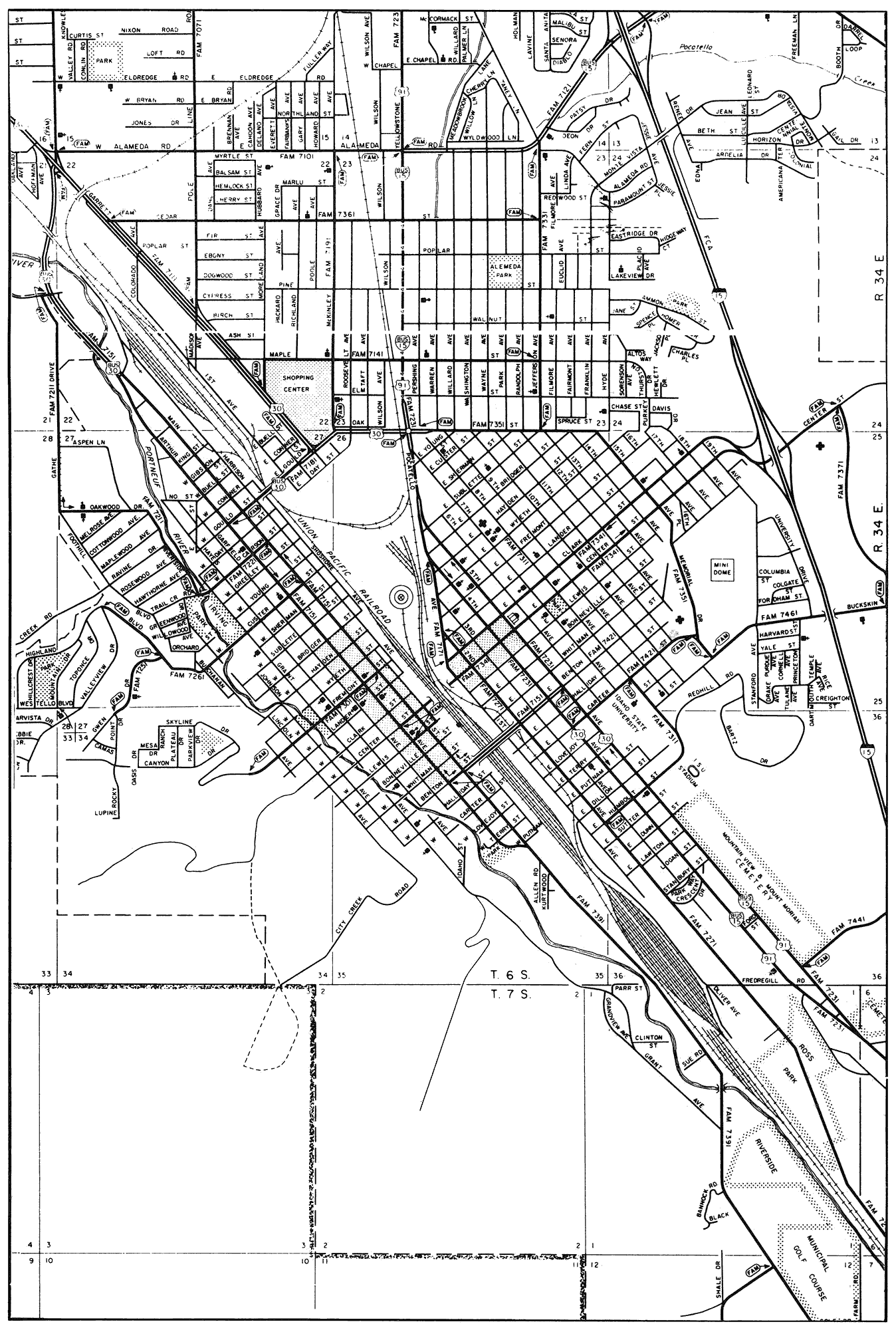
(right) 1992 map of the central Pocatello area, elevation 4,461. 1990 population of the metropolitan area (including Chubbuck) was 53,701. The area north of Oak Street was the original city of Alameda. Map from Idaho Transportation Department. Click on image for a larger view.