Page
147
|
Page
147
|
|
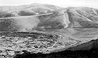
| A gathering summer thunderstorm over the southern end of the Lost River Range. Photo taken from near Craters of the Moon, (July, 1987). |
Snake
River Plain Aquifer
The Snake
River and its aquifer in many ways control the economy of Idaho. Three million
acres of farmland on the Snake River Plain are irrigated, with about 1/3 of
this from wells and the rest from canals. Idaho has the highest per capita water
consumption in the U.S.
At the INEEL, the water table is 200 to 1000 feet below the ground surface. The groundwater flow rate is 5 to 20 feet per day. An injection well, at the Idaho Chemical Processing Plant, was used to dispose of waste water used for cooling nuclear reactors from 1953 to 1984, and there has been surface disposal for thirty years. Leakage from evaporation ponds at the Test Reactor Area (TRA) has produced perched bodies of ground water containing radioactive isotopes above the main aquifer. Disposal of radioactive wastes at the INEEL has not yet harmed the quality of the Snake River aquifer in a major way, but radionuclides have been detected in the aquifer west of the INEEL, having migrated up to 7.5 miles in 20 years.
A more important, but less politically sensitive, threat to the purity of the Snake River Plain aquifer is agricultural runoff including potato processing waste, fertilizer and animal waste. In fact, these agricultural activities have near-sacred cow status among Idaho politicians.
In 1969, that was "less than half the estimated annual per capita expenditures of the National Reactor Testing Station of the U.S. Atomic Energy Commission at Arco." (arrington, 1969, reprinted in Etulain and Marley, 1974, p. 132) The New Deal per
capita expenditure was an order of magnitude (ten times) smaller than
the expenditure in 1990 of Department of Energy money for the Idaho National
Engineering Laboratory ($800 million dollars for 1 million people, or
$800 per capita). |
Big
Lost River Playas
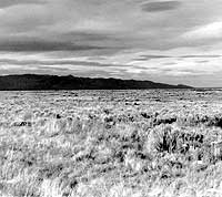
The area
at the mouth of the Little Lost River is a playa or dry lake bed, that fills
with water from the Big Lost River during wet years. During wetter times in
the Pleistocene, the two Lost Rivers and Birch Creek flowed into pluvial Lake
Terreton, centered near modern Mud Lake.